National Overview — Sunday, September 28, 2025
A developing tropical system (Tropical Depression Nine, likely to become “Imelda”) is edging closer to the Southeast coast, bringing increasing onshore winds, rough surf, and the first rain bands today. Heavier rain, stronger gusts, and coastal flooding ramp up late today into Monday, especially near the Carolinas. In the Pacific Northwest, a fall system delivers rain to lowlands and early-season snow over higher passes. Most other major corridors are seasonably quiet with just spotty showers. Localized flash-flood risk exists in a few areas—monitor local NWS updates along your route.
- Main drivers: Southeast tropical influences; Pacific Northwest rain/snow in the mountains.
- Elsewhere: Generally routine travel with occasional wet roads and brief visibility reductions under showers.
- Planning: Build extra time into ETAs and check 511/road cameras before coastal or mountain stretches.
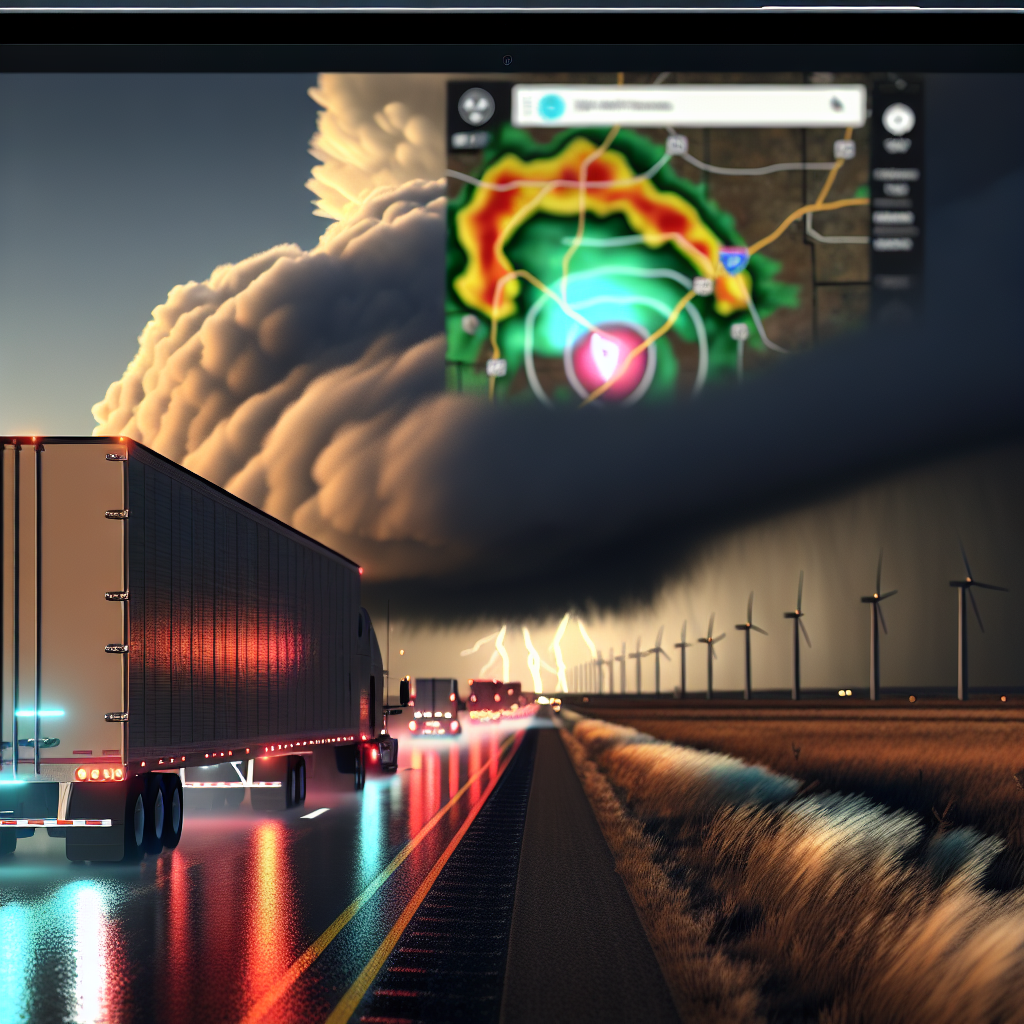
Hotspot 1: Southeast Atlantic Coast (FL–GA–SC–NC, I-95 Corridor)
What to expect today: Increasing onshore wind, rough surf, dangerous rip currents, and outer rain bands. Conditions worsen late today into Monday as TD 9 nears and may stall off the Carolinas, boosting the risk of heavier rain, coastal flooding, and stronger gusts. Squalls will cause quick ponding, hydroplaning risk, and sharp drops in visibility. Coastal routes may experience overwash around high tide.
- Corridors: I-95 from Daytona Beach–Jacksonville–Savannah–Charleston–Wilmington; connectors including I-10 (Jacksonville area) and I-4 (Orlando–Daytona).
- Impacts: Crosswinds on bridges and elevated roadways; brief urban flooding; spray and standing water near inlets and coastal causeways; sporadic debris blown onto lanes.
- Timing: Outer bands on and off through the day; conditions ramp late today through Monday.
- Driver notes:
- Secure light/empty trailers and reduce speed in squalls; expect shifting crosswinds.
- Stage coastal deliveries around high tide cycles when feasible to avoid overwash-prone stretches.
- Use extra following distance; avoid flooded lanes and do not drive through saltwater overwash.
- Watch for short-notice coastal advisories or closures and detours near low-lying approaches.
Hotspot 2: Pacific Northwest into the Inland Northwest (WA/OR Mountains)
What to expect today through tonight: Rain at lower elevations and early-season snow above roughly 3,000–4,000 feet with gusty winds over the higher passes. Expect slick, slushy travel with the potential for brief whiteouts as heavier showers move through.
- Corridors: WA Cascades (US‑2 Stevens Pass, I‑90 Snoqualmie) and OR Blue Mountains (I‑84 Deadman Pass/Emigrant Hill).
- Impacts: Reduced traction on compact snow/slush; visibility drops in snow bursts; wet brakes and longer stopping distances on downgrades; stronger ridge-top gusts.
- Timing: Greatest pass impacts this afternoon through tonight.
- Driver notes:
- Check 511 and pass cameras before climbing; be prepared for pass restrictions.
- Carry chains per company policy and perform pre-descent brake checks.
- Slow on curves/bridges where the first slush can be extra slick.
Additional Notes and Planning
- Localized flash-flood risk is noted today—monitor local NWS/WPC updates along your route.
- Most other U.S. corridors are seasonably quiet with spotty showers; still allow extra space and watch for ponding.
- Stay flexible with ETAs. Expect short-notice coastal advisories in the Southeast and potential pass restrictions in WA/OR.
Safety Tip of the Day
First-hour precipitation is the slickest: slow down early, increase following distance, avoid cruise control on wet or slushy roads, and make smooth, deliberate inputs—especially when entering squalls or cresting into snowy passes.
Sources: National Weather Service, Weather Prediction Center, state DOT/511 road cameras, The Washington Post weather coverage, NBC Right Now Weather.
This weather briefing was prepared exclusively for truckstopinsider.com.