National Overview — Sunday, October 19, 2025
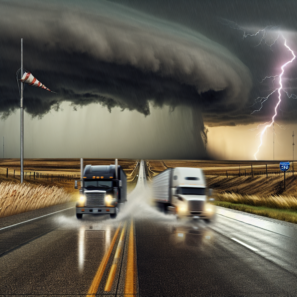
A strong cold front is pushing a squall line of thunderstorms from the lower Mississippi Valley through the Ohio Valley and Great Lakes through the daytime, then racing east into the Mid-Atlantic and Northeast tonight. Expect pockets of damaging winds, hail, and a few tornadoes ahead of the front, with breezy to windy conditions trailing behind it. Out West, the Pacific Northwest and northern Rockies turn unsettled with coastal and valley rain, mountain snow, and gusty winds. Drivers should plan for rapid weather changes along and immediately behind the front, secure loads, and prepare for crosswinds. In the Northwest and northern Rockies, check mountain pass conditions before evening climbs.
Mid-South to Ohio Valley and Great Lakes (Daytime)
Severe thunderstorms will impact major north–south and east–west routes as the squall line advances.
- Threat: Damaging wind gusts, isolated tornadoes, and brief flooding downpours.
- Areas: AR, TN, MO into KY, IN, IL, OH, MI, and southern WI.
- Primary corridors:
- I-40 (AR–TN)
- I-55 (AR–MO–IL)
- I-65 (TN–KY–IN)
- I-70 and I-71 (IN–OH)
- I-75 (OH–MI)
- I-90 and I-94 (IN/MI/WI)
- Driver notes:
- Expect rapid wind shifts and sharp visibility drops in the squall line.
- Brief flooding downpours may cause ponding and hydroplaning in low spots.
- Behind the line, plan for brisk crosswinds; secure light and high-profile trailers.
Mid-Atlantic and Northeast (Tonight into Early Monday)
A fast-moving squall line sweeps east after dark, bringing quick-hitting severe weather and poor visibility.
- Threat: Severe wind gusts, heavy rain, and embedded thunderstorms; localized power hits and ponding possible.
- Areas: VA, MD, DC, PA, NJ, DE into southern New England.
- Primary corridors:
- I-81 (VA–PA)
- I-95 (DC–MD–PA–NJ)
- I-76 and I-78 (PA–NJ)
- I-84 and I-91 (southern New England)
- Driver notes:
- Nighttime timing will compound reduced visibility in heavy rain; slow down in the cores.
- Gusty outflow winds may push vehicles on exposed bridges and open stretches.
- Watch for brief ponding in urban corridors and low-lying interchanges.
Pacific Northwest and Northern Rockies (Today–Tonight)
Unsettled weather spreads inland with coastal rain, mountain snow, and windy conditions.
- Threat: Rain and high-elevation snow with gusty winds; slick passes and reduced visibility over higher terrain.
- Areas: WA/OR coasts and Cascades into ID and MT.
- Primary corridors:
- I-5 (wind-driven rain along the coast)
- I-84 (Columbia River Gorge)
- I-90 (Cascades/Lookout Pass)
- I-15 and I-90 (MT/ID for higher-elevation snow)
- Driver notes:
- Expect rapidly changing conditions near and above pass level; verify pass status before ascent.
- Wet roads, slushy spots, and blowing snow will reduce traction and visibility over the mountains.
- Gusty winds along gaps and ridgelines can affect trailer stability.
Driver Safety Tip of the Day
Before entering the squall line or climbing into the Cascades and northern Rockies after dark, re-check your route and weather radar, secure and balance your load, and plan extra time for detours or slower speeds. Prepare for crosswinds immediately behind the front, and confirm pass conditions before any nighttime ascent.
Sources: National Weather Service, Weather Prediction Center, local NWS offices, The Weather Channel, state Departments of Transportation.
This weather briefing was prepared exclusively for truckstopinsider.com.