
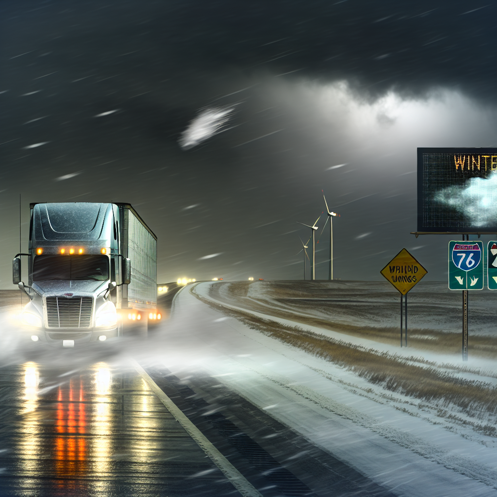
National Overview — Tuesday, November 11, 2025
An unseasonably cold Arctic air mass grips the eastern two-thirds of the country today. Downwind of the Great Lakes and across the central Appalachians, lake-effect and upslope snow continue with bursts of heavy snow, whiteouts, and blowing snow. Record or near-record early-season cold is affecting parts of the Southeast and even Florida this morning, bringing freeze concerns and patchy ice on elevated surfaces. The West is comparatively quiet today, with a stronger Pacific storm expected midweek.
Hotspot 1: Great Lakes to Interior Northeast — Lake-Effect Snow/Squalls
Expect narrow but intense lake-effect bands producing sudden whiteouts, blowing snow, and quick accumulations. Additional 4–8 inches is possible in favored belts, with winds gusting 25–35 mph within bands. Lake Effect Snow Warnings/Advisories remain in parts of northwest Pennsylvania and western/upstate New York.
- Key corridors: I-90 near Erie and Buffalo; I-79 corridor in PA; pockets along I-90/I-86 east of Lake Erie and east of Lake Ontario. Slick spots may linger around southern Lake Michigan after Monday’s heavy bands in northeast IL/northwest IN (I-65, I-80/90).
- Driving impacts: Rapidly changing visibility and lane conditions over short distances; drifting across exposed stretches; ramps/bridges ice up first.
- Trucker tactics: Slow down before entering bands, increase following distance, keep headlights on, and avoid sudden lane changes. If possible, stage rest or fueling south of the most persistent bands and time crossings between bursts.
Hotspot 2: Central Appalachians — Snow Showers, Blowing Snow, Gusty Winds
Snow showers with 1–4 inches in the lowlands and 3–6 inches in the mountains, locally higher. Strong northwest winds gusting 25–40 mph will cause blowing/drifting and rapidly changing visibility, especially on ridgelines and gaps.
- Key corridors: West Virginia mountains into adjacent western MD/southwest PA, including I-68 (WV/MD), I-77 (WV), and I-79 (WV/PA).
- Driving impacts: Slick grades, crosswind exposure on bridges and high ridges, reduced visibility in snow squalls.
- Trucker tactics: Maintain lower speeds on descents, space out on climbs, and be prepared for sudden gusts when clearing tree lines and entering elevated bridges. Consider delaying mountain passes during peak squalls.
Hotspot 3: Southeast and Coastal GA/SC into North FL — Hard Freeze/Wind Chills
Early-morning freeze and very cold wind chills are in place. Patchy ice is possible on bridges, overpasses, and shaded spots. Freeze Warnings/Cold Weather Advisories are active in parts of southeast GA and southeast SC, with widespread freeze concerns across much of GA.
- Key corridors: I-95 from Savannah to Charleston; I-16 near Savannah/Statesboro; I-75 across south-central/north GA and into north FL (Jacksonville area).
- Driving impacts: Black ice potential on elevated surfaces during the morning rush; reduced tire traction until pavement temperatures recover.
- Trucker tactics: Start slow and test traction on bridges, allow extra stopping distance, and verify cold-weather prep (antigel fuel treatment where needed, full washer fluid, defrosters functioning). Plan for slightly later departures to let sun and traffic improve surfaces where schedules allow.
Western U.S. — Quiet Today
Comparatively quiet conditions today. Use the window for maintenance, repositioning, and resupply ahead of a stronger Pacific storm arriving midweek.
Safety Tip of the Day
Cold plus bursts of snow amplify small mistakes. Before rolling, clear all lights and sensors, drain air tanks to reduce moisture freeze-up, and set conservative following distances. In squalls or on icy bridges, smooth inputs are critical—no sudden braking, steering, or throttle. If visibility drops to near zero, exit safely at the next opportunity rather than stopping in a live lane.
Sources: National Weather Service, Weather Prediction Center, local NWS forecast offices, state DOT updates, and The Weather Channel.
This weather briefing was prepared exclusively for truckstopinsider.com.