
National Overview — Thursday, September 18, 2025
A coastal low is exiting the Mid-Atlantic with early showers tapering and improving conditions by later today. Farther inland, rounds of thunderstorms are organized from the northern/central Plains into the Mississippi Valley. Tropical moisture is driving scattered storms with localized flash-flood risk across parts of the Southwest deserts. No organized snow hazards are expected nationwide today. Separately, Tropical Storm Gabrielle is over the open Atlantic and is expected to remain far from the U.S. mainland.
Hotspot 1: Northern Plains (ND/SD into western MN)
Threat: Heavy rain with localized flash flooding as repeated storms track over the same areas.
- Primary corridors: I-94 (ND), I-90 (SD), I-29 (Dakotas).
- Impacts: Ponding, hydroplaning, and reduced visibility. Slowdowns likely near construction zones and low-lying stretches.
- Driver strategy: Reduce speed in heavy rain, extend following distance, and avoid driving through water covering lanes—turn around at flooded low spots. Build extra time into runs along I-94/I-90/I-29.
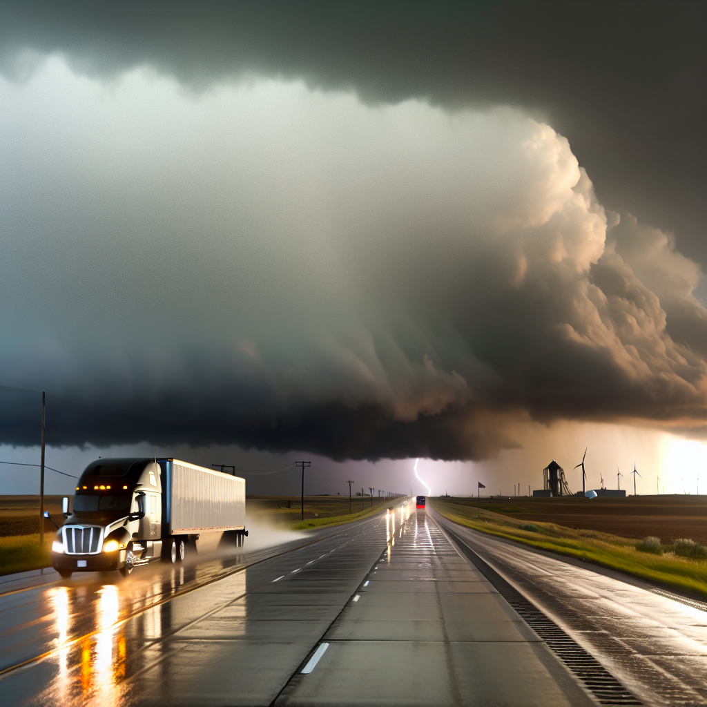
Hotspot 2: Southern High Plains and Southern Colorado
Threat: Strong to severe thunderstorms capable of damaging wind gusts, large hail, and a low tornado risk, especially from southern Colorado into the OK/TX Panhandle.
- Primary corridors: I-25 (Pueblo–Raton Pass), I-40 (Amarillo–OKC corridor), US-287.
- Impacts: Sudden crosswinds, pockets of wind damage, and hail. Brief road closures are possible from downed limbs or debris.
- Driver strategy: Secure light/empty trailers for crosswinds, identify sturdy shelter options along your route in case of hail, and be prepared to delay departures around the strongest cells. Do not stop in travel lanes during severe weather.
Hotspot 3: Southwest Deserts (southern CA into AZ/NM)
Threat: Scattered thunderstorms with brief torrential downpours and localized flash flooding as tropical moisture pushes inland.
- Primary corridors: I-8 (Imperial Valley–Yuma), I-10 (Palm Springs–Phoenix–Tucson), I-17 (Phoenix–Flagstaff), I-19 (Tucson–Nogales).
- Impacts: Rapidly changing conditions, sharp drops in visibility, water over dips/washes, and potential debris flows near recent burn scars.
- Driver strategy: Never drive across flooded washes; reroute or wait for water to recede. Watch for rock and debris near canyon cuts and burn scar areas. Keep headlights on in heavy rain and dust-out conditions accompanying storms.
Other Regional Notes
- Coastal Mid-Atlantic: Early nuisance showers and minor coastal effects fade through the day; expect better travel windows by afternoon and tonight.
- Snow: No significant snowfall hazards anywhere in the U.S. today.
Daily Safety Tip
Hydroplaning happens above about 35 mph on standing water. Slow down before entering water-covered lanes, avoid hard braking or sudden lane changes, and check tires and wipers before rolling into storm-prone zones.
Likely sources: National Weather Service, Weather Prediction Center, Storm Prediction Center, local Departments of Transportation, The Weather Channel, Associated Press.
This weather briefing was prepared exclusively for truckstopinsider.com.