
Friday, October 17, 2025 — National Trucking Weather Overview
A frontal boundary from the Mid-South into the Great Lakes will drive areas of showers and thunderstorms today, while much of the East stays cool and dry with pockets of early frost/freeze inland. Light high-elevation snow develops late day across parts of the northern Rockies. No tropical cyclones are affecting U.S. interests today.
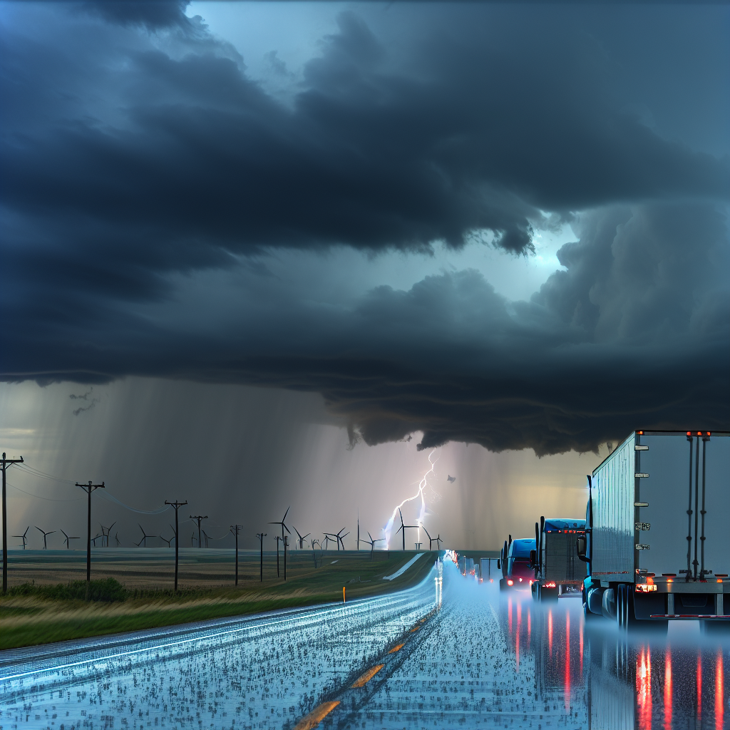
Hotspot: Central High Plains (eastern CO into northwest KS and southwest NE)
Timing: Early today
- Threats: Isolated strong to severe thunderstorms capable of large hail, damaging wind gusts, and a brief tornado.
- Primary corridors: I-70 (CO/KS), I-76 (northeast CO), I-80 (southwest NE).
- Impacts: Rapidly changing conditions near storms with sudden low visibility, wind shifts, and hail-covered pavement.
- Driver notes:
- Have a shelter plan at exits/rest areas if hail or severe wind approaches; avoid stopping under overpasses.
- Increase spacing in outflow winds; be prepared for strong crosswind gusts and pockets of blowing dust near storms.
- If a warning is issued along your route, consider delaying departure 30–60 minutes to let cells pass.
Hotspot: Midwest/Great Lakes Corridor (central IL → northern IN → southern MI)
Timing: Increasing this afternoon and tonight
- Threats: Showers and thunderstorms with localized 1–3 inches of rain, producing ponding and brief flooding in poor drainage areas.
- Main routes: I-55, I-57, I-65, I-69, I-70, I-94.
- Impacts: Hydroplaning risk on fast-moving lanes; water over low spots, ramps, and underpasses; slower urban commutes during heavier bursts.
- Driver notes:
- Reduce speed in heavy rain, increase following distance, and avoid driving through standing water.
- Plan extra time through metro stretches and consider fueling before the heaviest bands arrive.
- Expect scattered lightning; use enclosed shelters during stops.
Hotspot: Northern Rockies High Terrain (MT Absarokas and WY Bighorns)
Timing: Late day into evening
- Threats: Light to locally moderate snow above roughly 8,000–9,000 ft.
- Roads of concern: High passes on US-14/16/20 over the Bighorns; changing conditions near I-90 adjacent to higher terrain.
- Impacts: Slick spots and reduced visibility on higher passes; first-wintry-conditions feel of the season.
- Driver notes:
- Check pass conditions before ascent; allow for slower speeds and longer stopping distances.
- Use lower gears on descents; bridges and shaded curves may turn slick first.
- Carry cold-weather gear and follow company/state chain requirements if applicable.
Additional Notes for the East
- Interior Mid-Atlantic/Northeast valleys: Early-day frost/freeze pockets possible. Watch for patchy slick spots on secondary roads, ramps, and bridges.
- Much of the East remains cool and dry—favorable for on-time deliveries after any early morning frost lifts.
Safety Tip of the Day
Weather can change faster than your route plan. Before committing to a pass or storm-prone corridor, confirm latest conditions, fuel up early, and build a short delay buffer. Slow down in heavy rain or hail, increase following distance, and never drive through water covering the road.
Sources: National Weather Service, Weather Prediction Center, Storm Prediction Center, local NWS forecast offices, and The Weather Channel.
This weather briefing was prepared exclusively for truckstopinsider.com.