
National Overview — Saturday, November 8, 2025
A strong cold front is pressing south and east, driving a much colder airmass into the central and eastern U.S. Expect widespread gusty north winds behind the front. Light to moderate snow and areas of blowing snow will develop from the Northern Plains into the Upper Midwest and Great Lakes, while the West turns milder with improving travel away from higher terrain. Isolated showers and thunderstorms shift to the East Coast later today, bringing brief downpours and gusty winds.
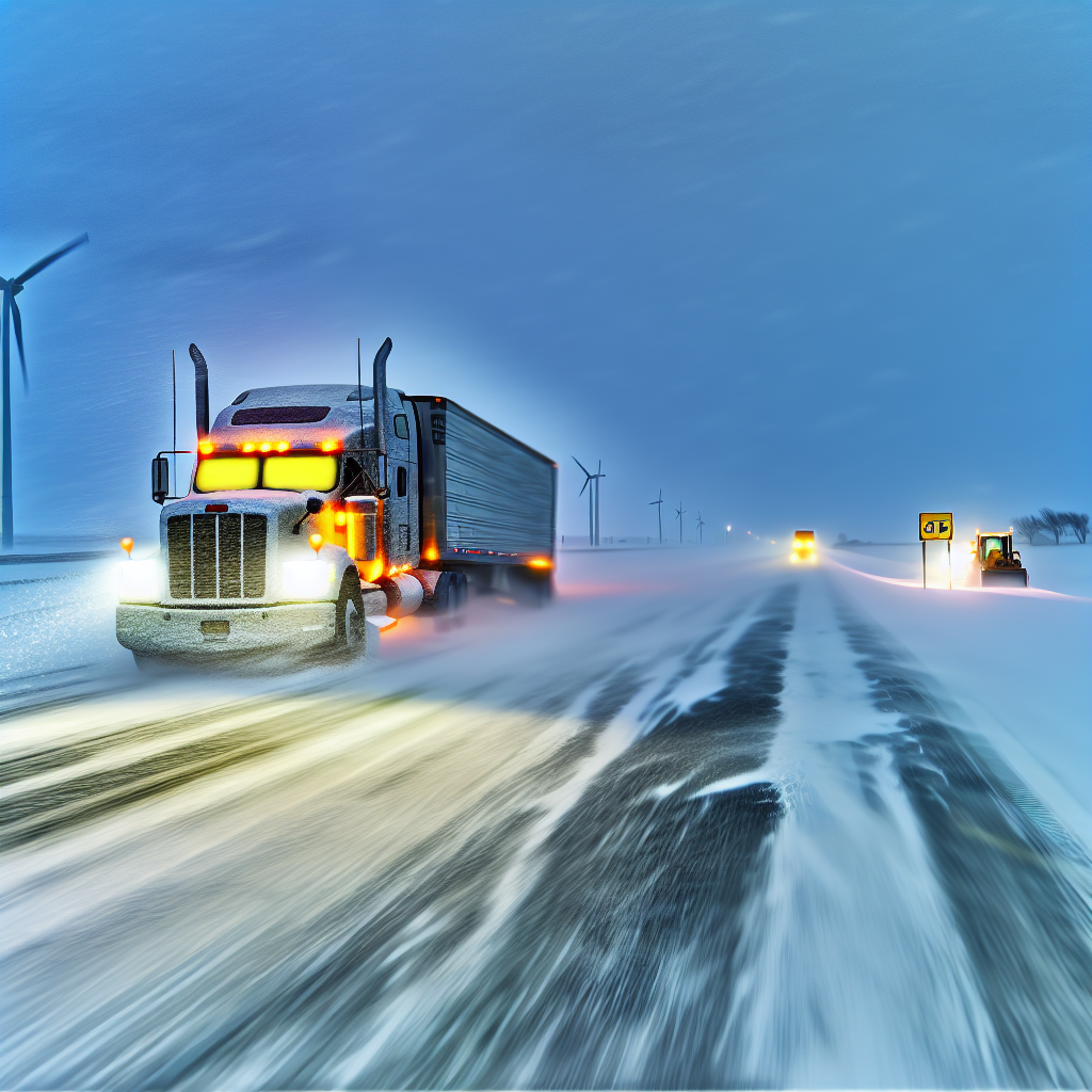
Northern Plains → Upper Midwest/Great Lakes
Areas: ND, SD into MN, WI, and MI
- Weather impacts: Light to moderate snow with periods of strong winds producing blowing snow and reduced visibility.
- Main corridors at risk: I-29, I-90, I-94, I-35 (MN/WI), I-75 and I-96 (MI).
- Driver notes:
- Plan for intermittent whiteouts, especially in open country and overpasses.
- Allow extra braking distance and reduce speed on ramps, bridges, and untreated stretches.
- Stage fuel and rest stops ahead of the snow band to avoid unnecessary pull-offs in low visibility.
Central U.S. Behind the Front
Areas: Central/northern Plains into the Mid–Mississippi Valley (NE, KS, IA, MO, IL)
- Weather impacts: A sharp temperature drop and brisk to strong northerly winds creating hazardous crosswinds for high-profile and light/empty trailers.
- Main corridors at risk: East–West routes I-80, I-70, I-72; North–South routes I-35 and I-55.
- Driver notes:
- Expect strongest crosswind exposure on open stretches and elevated bridges.
- Re-evaluate light or high-profile loads; redistribute weight and secure equipment.
- Consider adjusting timing to avoid the peak post-frontal wind surge.
East Coast (Late Day/Evening)
Areas: Carolinas to the Mid-Atlantic/Northeast
- Weather impacts: Scattered showers and a few thunderstorms along/ahead of the front with brief downpours and gusty winds.
- Main corridors at risk: I-95 and feeder interstates.
- Driver notes:
- Watch for rapid visibility drops in heavier showers and ponding in the right lanes.
- Increase following distance in urban corridors; wet braking distances will increase.
- Plan around rush-hour windows where the front arrives to limit congestion delays.
Planner’s Note for the West
Conditions trend milder with improving travel outside of higher terrain. The primary national impacts today remain the Plains-to-Great Lakes snow/wind band and post-frontal crosswinds farther south and east.
Safety Tip of the Day
Crosswinds and blowing snow demand speed management and space. Keep both hands on the wheel, reduce speed before exposed spans, and leave extra room when passing or being passed by large vehicles. If your trailer is light or empty, consider delaying through the windiest corridors until winds ease.
Sources: National Weather Service, Weather Prediction Center, state Departments of Transportation, The Weather Channel.
This weather briefing was prepared exclusively for truckstopinsider.com.