
National Overview
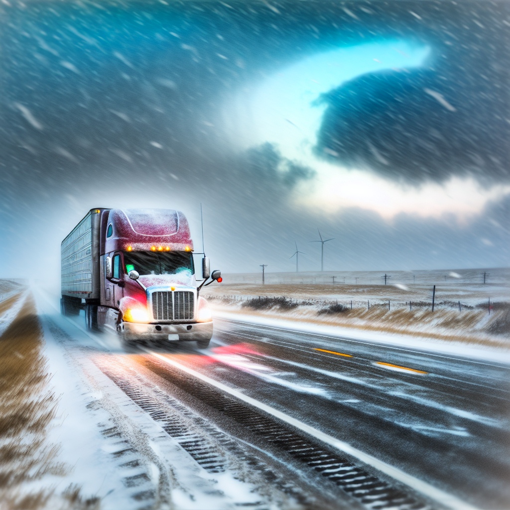
A strong early-season cold front has pushed into the central and eastern U.S., delivering much colder air, gusty winds, and areas of snow from the Northern Plains into the Great Lakes. Expect wintry travel impacts in these regions. The West is comparatively warmer and mainly dry. Critical fire weather conditions develop across parts of south-central Texas today.
Northern Plains to Upper Midwest/Great Lakes (ND, SD, MN, WI, MI)
Blowing snow and gusty northwest winds accompany light to locally moderate snow at times. Highs only in the 20s–30s will keep any untreated surfaces slick.
- Primary routes: I-90, I-94, I-29, I-35, and approaches to the Great Lakes corridors.
- Impacts: Crosswinds for high-profile vehicles, slick bridges/ramps, and reduced visibility in open country due to blowing snow.
- Driver notes: Reduce speed in gusts, increase following distance, and expect variable traction—especially on exposed stretches and overpasses.
Northwest Lower Michigan (Lake Michigan Snowbelts)
Lake-effect snow bands will produce locally heavier bursts with advisories noting 3–6 inches possible in spots. Roads will be slick, and conditions can change rapidly over short distances.
- Focus areas: Benzie, Grand Traverse, Leelanau, and western Manistee counties.
- Impacts: Quick drops in visibility and sudden transitions from wet to snow-covered pavement.
- Driver notes: Slow before entering bands, avoid abrupt lane changes, and allow extra time for hills and secondary roads.
South-Central Texas (San Antonio – I-35/I-10 Corridor and Surrounding Counties)
Red Flag Warning from 9 AM–9 PM CST. North winds 15–30 mph with gusts to 40 mph and relative humidity of 15–20% will support rapid fire spread. Blowing dust and strong crosswinds are possible.
- Primary routes: I-35 (Laredo–San Antonio–Austin), I-10 west/east of San Antonio, US-90.
- Impacts: Difficult handling for high-profile/empty trailers, localized visibility reductions in dust, and fast-moving grass fires.
- Driver notes: Secure tarps and light cargo, avoid parking in dry grass, eliminate ignition sources, and be prepared for sudden smoke or dust near open fields.
Safety Tip of the Day
Wind-aware driving: When encountering strong crosswinds, slow down before exposed spans, keep both hands on the wheel, and leave extra room when overtaking or being overtaken by other high-profile vehicles. If visibility drops in snow or dust, ease off the throttle, avoid sudden braking, and use steady, deliberate inputs until conditions improve.
Sources: National Weather Service, NOAA Weather Prediction Center, local NWS offices, state transportation agencies, and The Weather Channel.
This weather briefing was prepared exclusively for truckstopinsider.com.