
National Overview — Friday, November 14, 2025
A strong Pacific cyclone and an atmospheric river are the main drivers today, focusing impacts on the West Coast. California faces heavy rain, strong winds, and heavy Sierra Nevada snow, while much of the central and eastern U.S. stays warmer than normal and relatively quiet. Plan ahead for increasing rain and a few thunderstorms around the Great Lakes on Saturday.
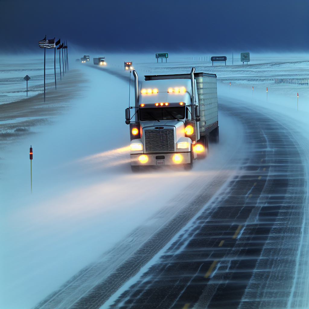
Northern and Central California, including the Sierra Nevada
Expect the toughest conditions along the coast, into the foothills, and over the high passes as periods of heavy rain and mountain snow move through. Ridge gusts near 40 mph will add to the difficulty, and a Slight Risk for flash flooding exists—especially near flood‑prone spots and recent burn scars.
- Road impacts: Hydroplaning and ponding on coastal/valley routes; heavy snow and rapidly changing conditions at higher elevations.
- Mountain travel: Anticipate chain controls and delays over high passes.
- Key corridors to monitor: I‑80 (Donner Summit), US‑50 (Echo Summit), I‑5, and US‑101.
- Operational tips: Stage chains before climbs, plan extra time, and avoid parking in drainages or below steep, burned slopes during heavier bursts.
Central to Southern California Coast and Mountains (Late Today into Tonight)
The moisture plume sags south toward the Central Coast/Cape Conception and the Transverse Ranges late today into tonight, maintaining a flash‑flood risk in favored terrain and complicating travel on coastal and mountain routes.
- Hazards: Brief torrential rain bands, debris on grades, and localized flooding in canyons and urban low spots.
- Wind: Exposure over coastal ranges and passes can challenge high‑profile vehicles.
- Key corridors to monitor: US‑101 (Salinas–Santa Barbara), CA‑154, and I‑5 over Tejon/Grapevine.
- Operational tips: Delay passage through narrow canyon routes during heavier bursts, verify pass status before committing to the Grapevine, and watch for rockfall after downpours.
Washington Cascades
Early‑season snows continue to create mountain pass restrictions. The North Cascades Highway (SR‑20) closed Thursday evening with no ETA to reopen. Additional wintry travel issues are possible on major passes.
- Pass focus: I‑90 (Snoqualmie Pass) and US‑2 (Stevens Pass) could see traction requirements and delays.
- Operational tips: Check pass reports before departure, carry chains, and expect slow travel where plows and chain‑up areas cause queues.
What to Watch
- Flood‑prone spots and recent burn scars in California during heavier bursts.
- High‑profile vehicle hazards in wind‑exposed coastal ranges and mountain passes of California.
- Rapidly changing conditions over the Washington Cascades and the high Sierra—verify pass status and traction requirements before crossing.
Safety Tip of the Day
Never drive through flooded roadways, and reduce speed in heavy rain or wet snow to prevent hydroplaning. Top off fuel and coolant before mountain crossings, stage chains early, and leave extra stopping distance in crosswind‑exposed areas.
Sources: National Weather Service, Weather Prediction Center, state Departments of Transportation, and regional news outlets.
This weather briefing was prepared exclusively for truckstopinsider.com.